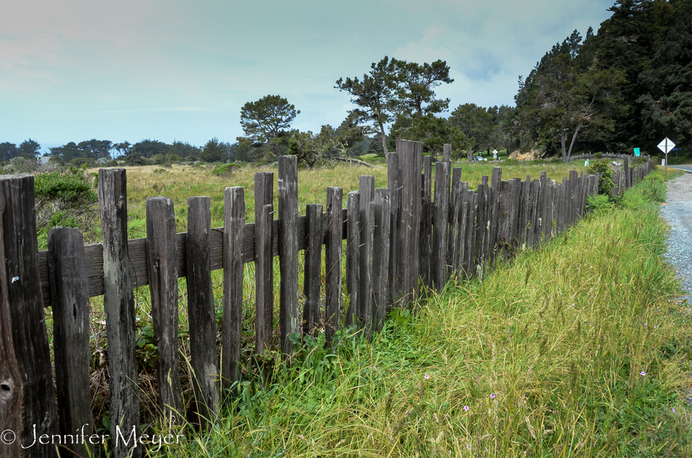
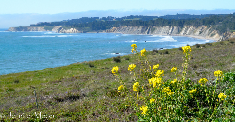
Weathered wood fences line Highway 1.
When we left Linda’s Land near Port Arena, she headed north back to Eugene, and Kelly followed us to our next destination on the Russian River (near Cloverdale). Even though Cloverdale is directly east of Port Arena, there is no easy or fast way to get there from the coast. Linda directed us to follow two back roads back to Highway 1, then take another back road through Stewart’s Point, over the coastal mountains to Highway 101. She hadn’t actually driven it, she admitted, but knew someone who had driven a 40-foot RV over it and insisted that it was much more direct than anything else.
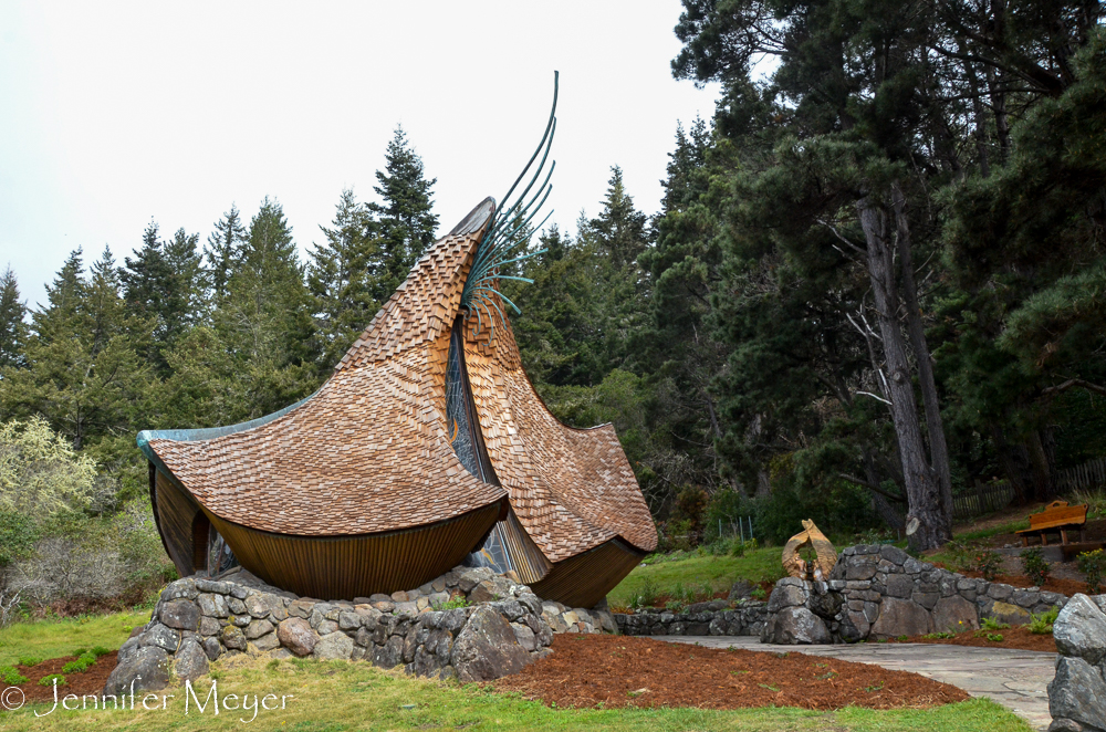
Sea Ranch Chapel.
We were dubious, but off we went, towing the CRV behind us and leading the way for Kelly. When we got to the coast, we stopped at milepost 55, at Linda’s suggestion, to visit a chapel that she encouraged us to see. I thought maybe it was to pray for our safe crossing back to civilized roads. But it was truly a chapel worth visiting. A little work of art on a hill. Nondenominational and open to the public for private repose.
Note: Actually, you can’t drive an RV or even a trailer to its parking lot, but we pulled into the volunteer fire station lot just past it, and since no one was there, Kate and Kelly stayed with the vehicles while I walked back and took photos.
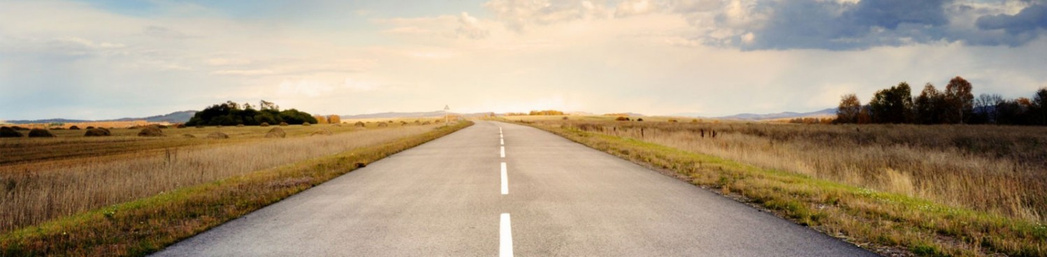
Typical view from the highway.
Just a little further down the highway, Kelly (who was leading now) pulled over in a pullout and waved us over. We thought she must be having trailer trouble, but actually, she’d spotted a pod of whales from the road and pointed them out to us through the trees. We watched for 10 or 15 minutes while a small group of whales frolicked in the bay, flipping tails and fins and moving in circles. Kate, who absolutely loves whales, was elated.
Soon after that, we came to the road to Stewart’s Point, Linda’s suggested route. We pulled off to the highway to wait for Kelly, but when we watched a truck gunning its engine to get up the steep narrow road we were supposed to take, we said, “No way,” and led Kelly further down Highway 1. We would have to stay on Hwy 1 all the way to Jenner and take Highway 116 inland to Guerneville. From Guerneville, there was another road that would take us to Cloverdale.
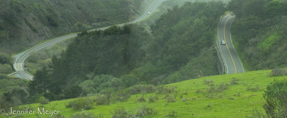
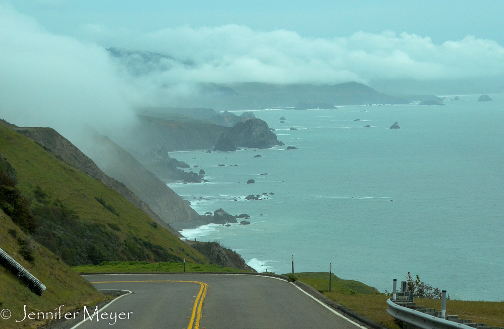
All one twisty road.
This particular stretch of Hwy 1 was surely the most spectacular of all. At times, it looked like Ireland, other times Gibraltar. There were brilliant green hills and orange poppies and freerange cows. The road was crazier than ever. One hairpin turn after another. At high points, you could see the twists and turns all the way down the mountainside. It was a gorgeous day and everything about the place seemed surreal. All but my sweaty palms gripping the wheel. Kate took photos through the bug-spotted windshield, and I just crept slowly along, stealing glimpses of the view when I safely could. It was only after we were safely down the steepest hill to Jenner that I realized the car’s brake assist wasn’t working anymore. No use trying to figure out why. We were through the worst, and I would just have to drive even more carefully. (Was that possible??)
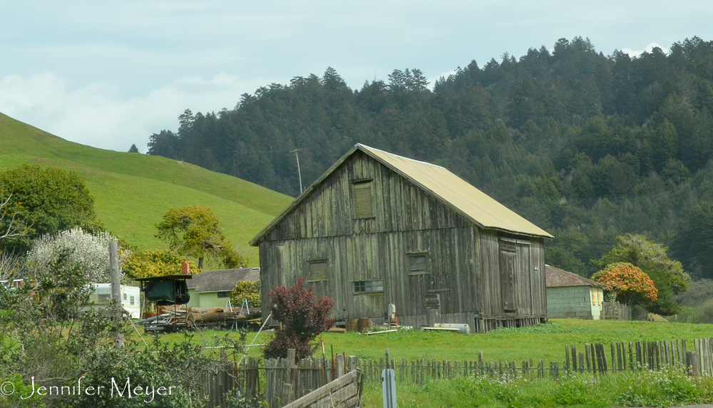
Barn on Highway 116.
Guerneville looked like such a fun, funky touristy town in the redwoods, and we might have stopped if parking Bessie and the tow car weren’t so difficult. Instead, we plowed on. When we got to the road to Cloverdale, there was a sign saying that the road was closed due to a washed out bridge (in a drought?). We pulled off the road, and had a quick lunch and regrouped. We could drive further south to Sebastian and get a road over to Santa Rosa, then drive north to Cloverdale. It was 4:00 before we finally got on the four-lane (albeit rough) Highway 101, and I had never been happier to see normal highway traffic.
After reaching our destination, I swore I’d never drive those roads again, but the next day, Kelly had still not found her new iPad. and when she called the café in Port Arena, she was so relieved to find that they had it, she planned to drive back over the following day and get it. We decided we’d go along with her, take the dogs and visit a beach. Driving in a car would be much easier, and we could take that Stewart’s Point road that was more direct.
Well, it wasn’t so quick. It was so narrow and windy, with such sheer drop-offs, that we couldn’t stop imagining how horrible it would have been to drive Bessie on it. At one point I made Kelly stop and let me get in the back seat where I could read my book and stop gripping the dash, peering down gullies into potential graveyards.
Finally back to the coast!
It was two and a half hours before we hit the coast, and we made it back to Point Arena (and Kelly’s iPad – yay!!) in time for an early dinner at the pier before heading back to Cloverdale. This time we went north and took Mountainview Road to Highway 128. This is the road we should have taken to begin with. Still windy and steep at times, it had a regular shoulder for most of it, and we got back to camp in just two hours, and we got through the worst of it before dark.
Wonderful to have you visit. Then to see your travelling home next day.
Looking forward to followingyour adventure.
Jennifer, your pictures of the coast are absolutely gorgeous! And as they say, one picture is worth a thousand words. When you write about windy roads and navigating Bessie on them, it’s one thing, but to see the roads….yeesh!